Campaign Bertolina 201505
Created martes 12 mayo 2015
Agustin.Lobo@ictja.csic.es
This is a Live Document
Updates are made without notification
Distribution List of these pages
- ICTJA-CSIC
- Hemav
- cferraz@hemav.com
- gil.hemav@gmail.com
- amas@hemav.com
- Marc Ronquillo <mronquillo@hemav.com>
- BIOGEI
- teresa.sebastia@ctfc.cat
- "Mercedes Ibañez Raffaele" <mercedes.ibanez@hbj.udl.cat
- Teresa mari <teresa.mari@ctfc.es>,
- Leticia Sanemeterio <leticia.sanemeterio@unavarra.es>,
- Haifa debouk <haifa.debouk@ctfc.cat>,
- "esther.iniguez" <esther.iniguez@ctfc.es>,
- Agustin Lobo <Agustin.Lobo@ictja.csic.es>,
- Helena Sarri <helena.sarri@ctfc.es>
- intiluna@gmail.com
- Burkart, Andreas <an.burkart@fz-juelich.de>
- Josep Anton Morgui <josep-anton.morgui@ic3.cat>
Please do not share this link and/or its contents with others. Le me (Agustin.Lobo@ictja.csic.es) know in case you think other people migt be interested and I will make the necessary consultations
Site
- La Bertolina, (1.661389E, 42.098889N), 1300 m asl
- Area: the strict area of interest is 395 m x 280 m (11.6 ha)
- Vegetation: Montane Dry Calcareous Grassland
- Vegetation Map of Catalunya: code 44. "Pastura calcícola i mesòfila: Euphrasio-Plantaginetum mediae"
- Climate data
- Nearby Meteo stations with real-time data and webcams (thanks Meteoclimatic !!)
- Situation:
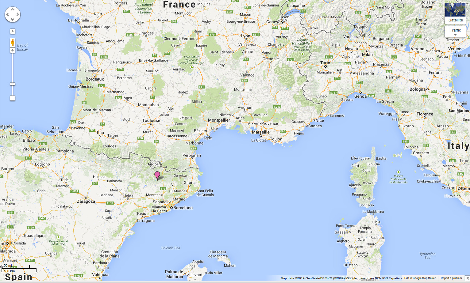
- Access:
- Barcelona - Manresa,
- then follow C55 direction Solsona.
- After Cardona, before km 65 in C55, take small road to Naves.
- Take C26 to the left (direction Solsona)
- Take small road (beware of trucks not expecting you!) direction Bassora, Pla de Bussa and Bartolina (use provided GPX)
- GPX from C55 Km 65 (after Cardona) to La Bertolina
- KML from C55 km 65 (after Cardona) to La Bertolina
- Logistics: no food available within a radius of ~1h drive
- You must bring your food for the day
Previous Work Relevant for this campaign
- Campaign Bert20130601
- Presentation "Remote Sensing at “eddy covariance” Sites. Methods and Perspectives from lessons learned in La Bertolina"
- Map of Fairy Rings 20130601
- A3 pdf Map of Fairy Rings 20130601
- A0 pdf Map of Fairy Rings 20130601
- GeoTif Map of Fairy Rings 20130601
- Multi-spectral image 20130602
- A3 pdf CIR composite
- GeoTif CIR composite
- GeoTif multispectral mosaic
Objectives
- Goal 1: High resolution georeferenced RGB mosaic of the grassland to map fairy rings
- RGB mosaic of the grassland at resolution better than 0.1 m
- Goal 2: Photographic sampling of ground sampling sites
- Transects of very detailed RGB photos at the Fairy Rings ground sampling sites
- Goal 3: Photographic sampling for vegetation inventory
- Scattered Photographic sampling with very detailed RGB photos to support the interpretation of products derived from multi-spectral mosaic
- Goal 4: Multi-spectral mosaic for Vegetation dynamics
- Multi-spectral mosaic of the grassland at resolution better than 0.5 m
- Goal 5: Spectro-radiometric measurements from UAV
- Transects of spectro-radiometric readings at the Fairy Rings ground sampling sites
- Scattered spectro-radiometric readings
See left index for details
Responsabilities
- Coordinator of aerial campaign
- Coordinator of field campaing
- teresa.sebastia@ctfc.cat (o Merche?)
- Responsible of aerial operations