Goal 1
Created miércoles 13 mayo 2015
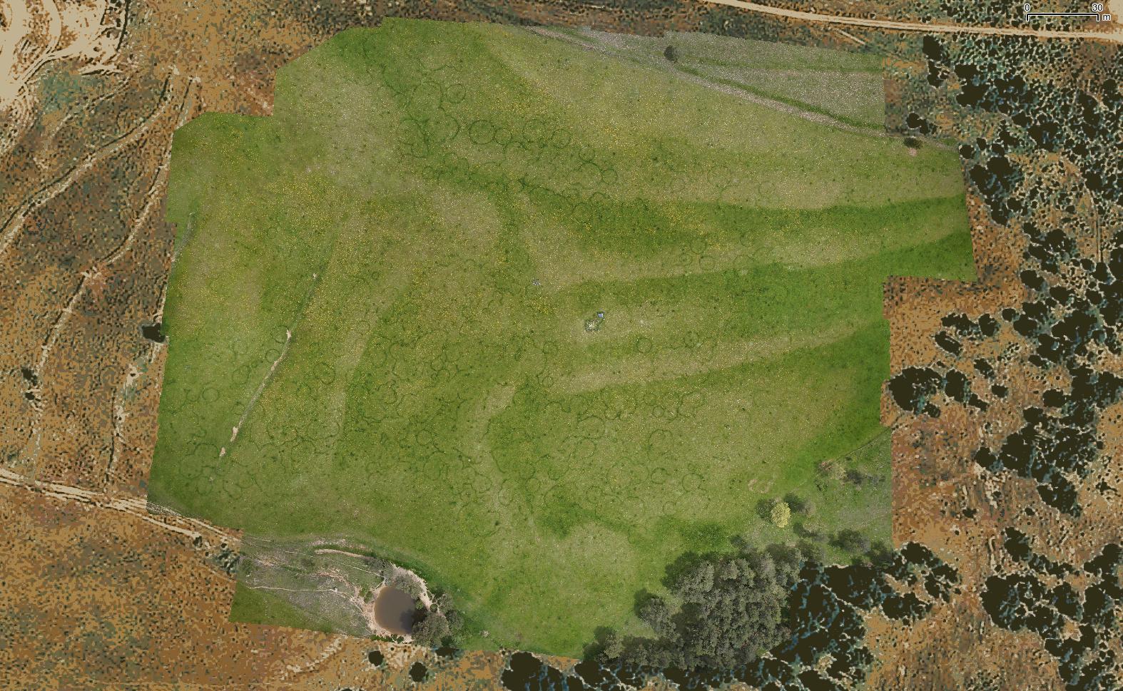
Goal 1: High resolution georeferenced RGB mosaic of the grassland to map fairy rings
Specification of Final product 1:
- Must match or outperform the 2013 product Bertolina2013 Bert20130601Alphav1.tif
- Mosaic resolution: better than 0.1 m
- Download full resolution image Bert20130601Alphav1.tif
1.1. Flight characteristics and equipment
- Area to be covered 395 m x 280 m (11.6 ha)
- Camera: Sony NEX 7n
- Focal: 18 mm
- Speed: 1000
- Aperture: Automatic
- Ginbal: designed for Sony NEX
- Height: 100 m
1.2 Deliverables by HEMAV
Images and necessary files to create the mosaic using Agisoft PhotoScan
- X images of 130.6 m x 86.7 m and 2.17 cm/pixel resolution
- Overlap among images 80%
- Images of color scales acquired at the begining and end of the campaign
- File 1 with
- image name
- time of acquisition
- X coordinate of image center
- Y coordinate of image center
- Z coordinate of image center
- pitch
- rol
- yaw
- FIle 2 of flight parameters (to evaluate flight quality) with
- time
- X,Y,Z
- pitch,yaw,rol
- Calibration file of the camera
1.3 Field work
1.3.1 Ground marks
- 12 ground marks with sub-metric GPS positioning must be visible in the ensemble (ALOBO)
- Color scales HEMAV + ALOBO
1.3.2 Field sampling
Same sites as for Goal 2
Link to Merche