Goal 2
Created miércoles 13 mayo 2015
Goal 2: Photographic sampling of ground sampling sites
RGB photographic documentation of sampling sites and vegetation inventory
Specification of Final product 2:
- Must match or outperform the 2013 product of Bertolina2013
- Photo DSC01547.JPG (4912 x 3264 pixels) taken from 4.375m agl covering 6.48 m x 4.26 m with 1.319 mm resolution
- Download Full resolution image (4912 x 3264)

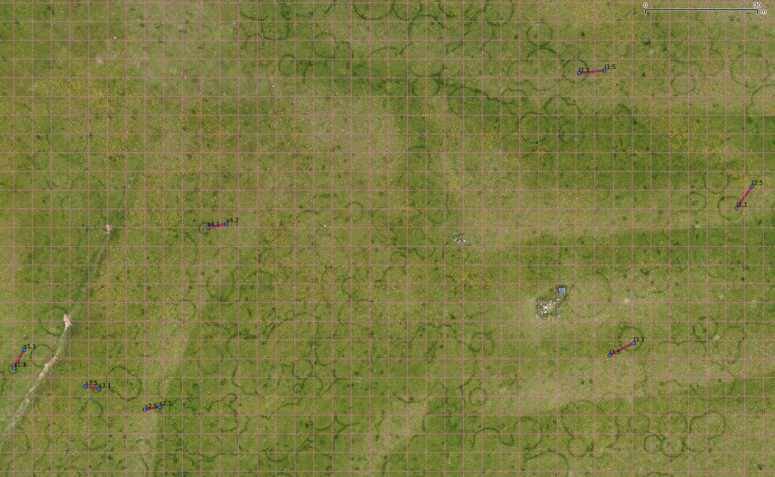
2.1. Flight characteristics and equipment
- Area to be covered: 7 linear transects of 3-5 photos across fairy rings
- Camera: Sony NEX 7n
- Focal: 18 mm
- Speed: 1000
- Aperture: Automatic
- Ginbal: designed for Sony NEX
- Height: 5 m
NOTE: transects will be marked with metric tape on the ground by the field team
2.2. Sites
- Shapefile with 1st and last points
- CSV file with points on transects (Spaced 1m)
- Shapefile with points on transects (spaced 1m)
2.3 Deliverables
Initially we do not plan making mosaics for each transect. The goal of these images is analyzing vegetation composition along the transect and documenting the site before destructive sampling.
But we want to keep all necessary information in case we would decide going ahead with the mosaics at a later stage.
Images and necessary files to create the mosaic using Agisoft PhotoScan
- X images of 6.5 x 4.3 m with 0.11 cm/píxel resolution HEMAV?
- Overlap among images ~80% HEMAV?
- File 1 with
- image name
- time of acquisition
- X coordinate of image center
- Y coordinate of image center
- Z coordinate of image center
- pitch
- rol
- yaw
- FIle 2 of flight parameters (to evaluate flight quality) with
- time
- X,Y,Z
- pitch,yaw,rol
2.3 Field work
Notes on vegetation composition and structure taken along detailed ground sampling of Merche