WorldView3
Created Saturday 08 October 2016
http://content.satimagingcorp.com.s3.amazonaws.com/static/galleryimages/worldview-3-spectral-bands.jpg
http://www.satimagingcorp.com/satellite-sensors/worldview-3/
http://content.satimagingcorp.com.s3.amazonaws.com/static/satellite-sensor-specification/WorldView-3-PDF-Download.pdf
- Swath: 13.1 km
- Revisit Frequency(at 40°N Latitude)
- 1 m GSD: <1.0 day
- 4.5 days at 20° off-nadir or less
- Resolution
- Pan 31 cm
- Multi (VNIR) 1.24 m
- Multi (SWIR) 3.7 m
- CAVIS 30 m
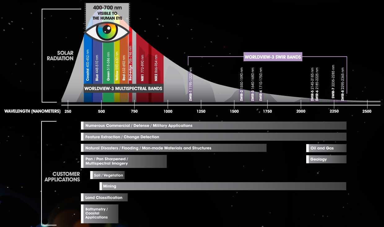
BandNb	BandName	wlmin	wlmax
1	Coastal		400	450
2	Blue		450	510
3	Green		510	580
4	Yellow		585	625
5	Red		630	690
6	RedEdge		705	745
7	Near-IR1	770	895
8	Near-IR2	860	1040
/Users/agustinlobo/Dropbox/SaharaDropb/sahara_datatest/wv3bands.csv
Area mínima: 25 km2
Precios aprox de ARCHIVO
· SWIR 7.5 m 24 €/km2
· MS 4 bandas 30 cm 22.5 €/km2
> 25*(24+22.5)
[1] 1162.5
Precios aprox de PROGRAMACIÓN
· SWIR 7.5 m 34 €/km2
·MS 4 bandas 30 cm 32.5 €/km2
> 25*(34+32.5)
[1] 1662.5
https://imagehunter.apollomapping.com/search/6d3caf47385c48289217ee0fb8638d4c